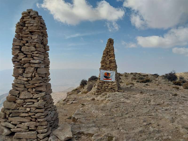
قله سپیدار از مسیر میمنداستان فارس
میمند روستای تنگ ریز ، فارس
نیمرخ ارتفاع
کمترین ۲٬۹۹۸ متر بیشترین ۳٬۱۷۴ متر مجموع فرود ۴۰۳ متر
گزارش برنامه
قله سپیدار
از شیراز تا دکل مخابراتی ۱۴۵ کیلومتر
از پارکینگ تا قله ۵ کیلومتر
زمان صعود ۱/۴۰دقیقه
زمان فرود ۱/۳۰دقیقه
مسیر از طرف میمند روستای تنگ ریز
از روستا تا ایستگاه هواشناسی ۱۳ کیلومتر
کوه سپیدار نام یکی از کوه های استان فارس می باشد.
این کوه جزو ارتفاعات غربی استان فارس می باشد که از فرمشکان کوار شروع می شود و تا تادوان خفر ادامه می یابد همچنین دهستان خواجه ای فیروز آباد و بخش میمند در جبه جنوبی این کوه قرار دارند.
رشته کوه سفیدار از بلندترین ارتفاعات جنوب کشور محسوب می شود که قله های بلند آن تقریباً نیمی از سال پوشیده از برف هستند، از ذوب شدن این برف ها سفره های زیر زمینی منطقه فرمشکان کوار و خفر تغذیه می شوند که به خصوص در منطقه فرمشکان به برکت وجود این کوه شاهد چشمه های فراوان و پرآبی هستیم.
در تمام دره های زیبای این کوهستان چشمه های کوچک و بزرگی جریان دارد و در کنار فضای جنگلی این کوهستان حیات وحش بسیار زیبا و دل انگیزی به وجود آورده اند. تنها راه ماشینی این کوه از طرف میمند و در کنار روستای تنگه ریز می باشد.
روستاهای تنگریز، گنک، شبانکاره، بنه خفرک ، آبگل، جانی آباد، دهستان فرمشکان کوار شامل دهشیب، دشت شاهرضا، خرمایی، هکوان، کدو و علی آباد روستای کرفت روستای شاغون روستای آبسرد روستای فشان شهر میمند شهر کوار
Sepidar Peak
From Shiraz to the telecommunications tower, 145 km
5 km from the parking lot to the peak
Ascent time 1.40 minutes
Landing time 1.30 minutes
The route is from Meimand village of Tang Riz
13 km from the village to the meteorological station
Sepidar mountain is the name of one of the mountains of Fars province.
This mountain is one of the western heights of Fars province, which starts from Formashkan Kovar and continues to Tadwan Khafar. Also, Khojae village of Firozabad and Meimand section are located on the south side of this mountain.
The Sefidar mountain range is considered one of the highest elevations in the south of the country, whose high peaks are covered with snow for almost half of the year, and the melting of these snows feeds the underground aquifers of the Formashkan area of Kovar and Khafar, which especially in the Formashkan area Thanks to the existence of this mountain, we see many springs with abundant water.
Small and big springs flow in all the beautiful valleys of this mountain, and next to the forest area of this mountain, they have created a very beautiful and heartwarming wildlife. The only car road to this mountain is from Meimand side and next to Tengeriz village.
The villages of Tangriz, Ganak, Shabankare, Bene Khafarak, Abgol, Jani Abad, Farmashkan Kovar district including Deshib, Shahreza plain, Khormai, Hekvan, Kodu and Ali Abad, Karft village, Shaghun village, Absard village, Fashan village, Maimand city, Kovar cit
تصاویر ۲

نظرها ۰
هنوز نظری برای این مسیر ثبت نشده است.